


 Kevin Bloody Wilson Aussie Icon Tour with special guest Jenny Talia
27 Mar 2026 - Renmark
 The Italian Tenors
09 Apr 2026 - Renmark
 Ireland The Voyage
24 Feb 2026 - Renmark
 Cirque Nouvelle
14 Apr 2026 - Renmark
 Song Sung Blue. The Neil Diamond Experience featuring Troy Harrison. A Story in Every Song.
06 Mar 2026 - Renmark
Thanks for using Discover Murray River
Caurnamont Water Level Updates
Here are some recent photos of water levels at Caurnamont:
Photos Uploaded in January 2010
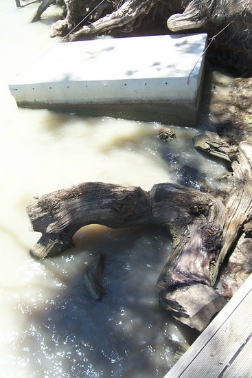
Caurnamont on 06/12/2009
Photo: Kristine Sims
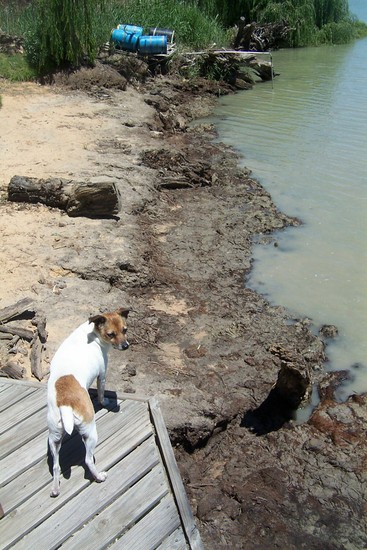
The Gazebo which a dog stands on the corner off is normally in the water - current water levels expose about 10 feet of beach
Photo: Kristine Sims
The Gazebo which a dog stands on the corner off is normally in the water - current water levels expose about 10 feet of beach
Water level photos from towns near Caurnamont


There's PLENTY of water for a great holiday in Caurnamont!
All photos and descriptions are supplied by the community. If you have anyrecent photos of the Murray, please upload them to help us show that
there's plenty of water for fun and adventure!

Caurnamont Town Guide
Towns Close By: Mannum, Walker Flat, Swan Reach, Purnong, Nildottie, Bowhill, Wongulla, Younghusband
Tell your friends you found this at murrayriver.com.au!
Copyright Discover Murray 2026. This site or any portion of this site must not be reproduced, duplicated, copied, sold, resold, or otherwise exploited for any commercial purpose that is not expressly permitted by DISCOVER MURRAY.